Project Description:
At the start of this project, we began brainstorming questions we couldn’t just look them up. This included finding an answer and problem-solving. The method used to problem solve included asking good questions, creating a mathematical framework, doing the math and reflecting on a result. My question was what is the fastest route from Chapman Hill to Animas High school? I answered this problem with timing how long it took me to get to school on route 1: US-160W and on route 2: and comparing them as well as using google maps. From there I started working on the math from the information I already had. Such as figuring out distance and estimated time for both routes and how many signs and stop lights there were.
I then dived the routes into parts. Figuring out the speed and transferred those to feet per second, figured out the distance in feet between the speeds. I did the same in seconds and from there I got a total of both routes and the time difference for each individual route. My final results: From google maps is the Florida route is shorter due to fewer stop lights and traffic flow. In the end I enjoyed the project and if I were to do it again I would change I think the way I had framed my question and math in a more simple way. I think I overcomplicated my math and in the process, something went wrong.
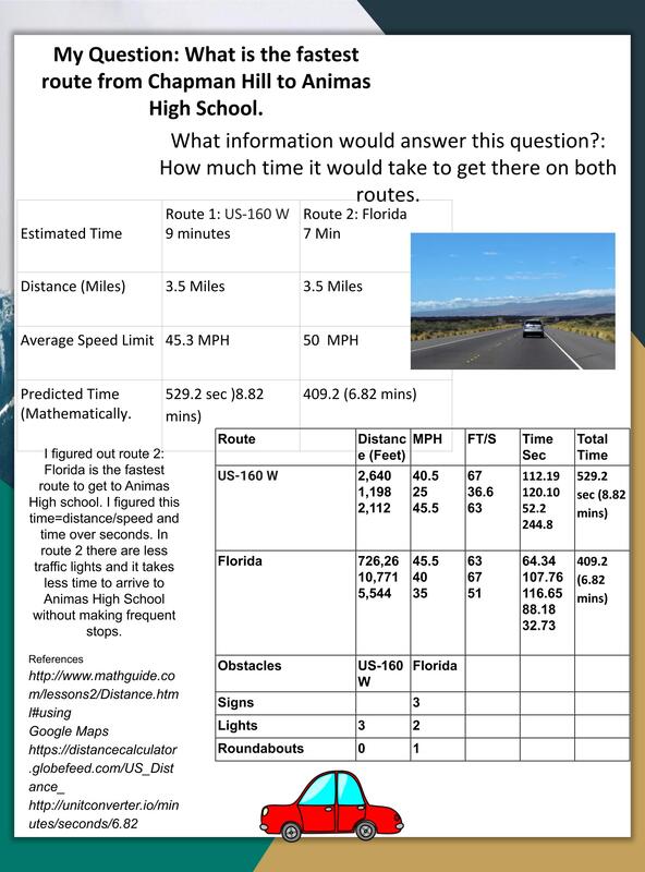
Photo used under Creative Commons from Coastal Elite
